Precision Surveying, Beyond Boundaries.
Delta Coast Consultants specializes in an array of surveying services, catering to a range of project requirements. Our expertise encompasses Boundary/ALTA Surveys, ensuring precise property delineation and compliance with high standards. We conduct detailed Topographic Surveys to capture the lay of the land for insightful planning and design. Our Hydrographic & Geophysical Surveys facilitate a comprehensive understanding of aquatic environments, while Multibeam and Side Scan Sonar Surveys offer advanced sub-aquatic terrain mapping. Additionally, we harness UAV technology for Lidar, Video, and Photographic Surveys, providing high-resolution aerial data capture for accurate, real-time insights. Each service area is executed with an unwavering commitment to precision, client needs, and regulatory adherence.
Our practice in surveying and mapping is grounded in a keen understanding of property rights and boundaries, innovatively applying our expertise to various projects. Our team, proficient in the latest surveying techniques and regulations, conducts detailed assessments of land and waterways. With a focus on safety and client-centric service, we offer swift and precise surveying responses to meet the needs of commercial, industrial, and residential sectors.
Providing Advanced Mapping Precision, Exceeding Standards
With advanced technology, we deliver unparalleled precision in surveying and efficient mapping across various terrains.
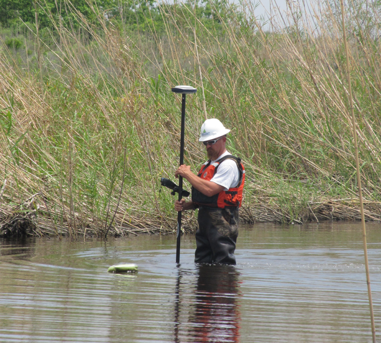
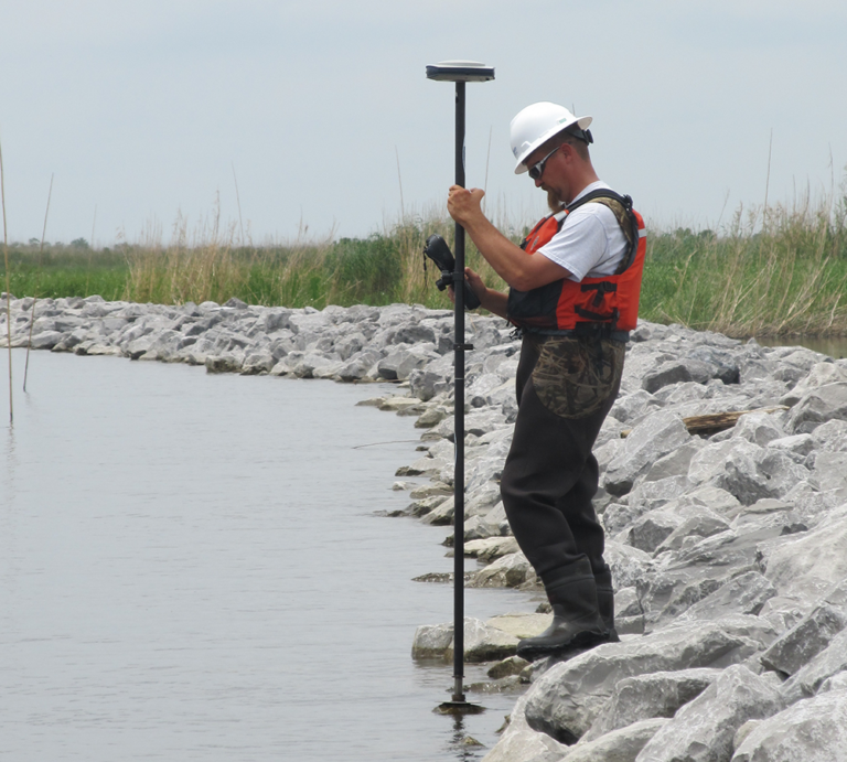
Precision is the cornerstone of any engineering project, and that begins with accurate field services and surveying. We utilize state-of-the-art equipment and technologies such as RTK GPS, multibeam echosounders, fathometers, side scan sonar, magnetometers/gradiometers, Acoustic Doppler Current Profilers, unmanned aerial vehicles, boats, airboats, and ATV’s to collect the most accurate and comprehensive data. This information becomes the foundation upon which design and implementation decisions are made, ensuring your project is executed to the highest possible standards.
Our Construction Surveys division specializes in providing state-of-the-art surveying services for a wide range of projects, including pipelines, roadways, drainage systems, sewer and utility networks, as well as subdivisions, buildings, and infrastructure. From permit drawings and applications to the execution of detailed property surveys, we ensure every phase of construction, from inception through to final inspections, is guided by precision and meticulous attention to detail.
Services Include:
- Survey Layout Services
- Construction Stakeout and Positioning
- Compliance Surveys
- Quantity and Payment Surveys
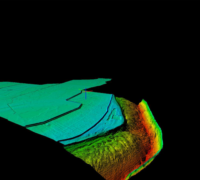
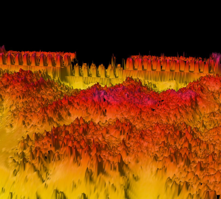
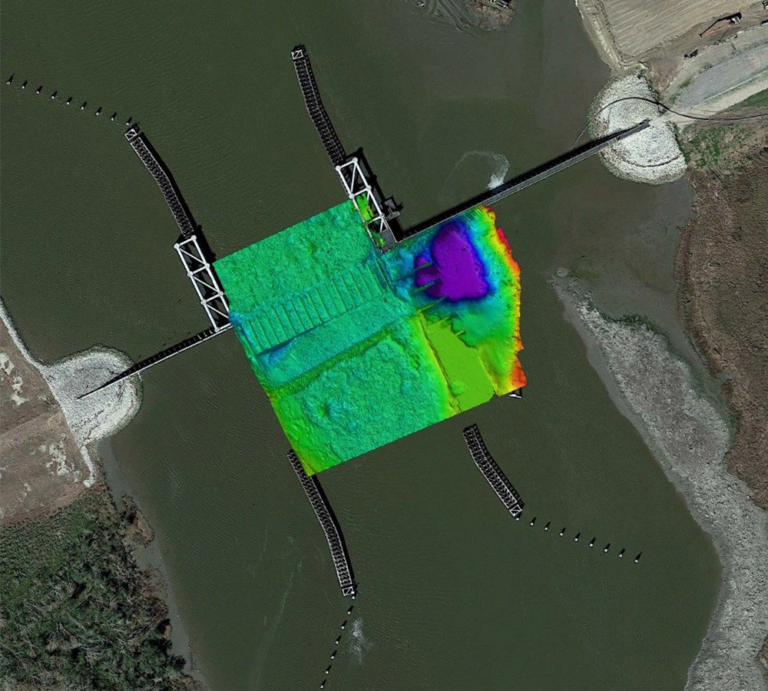
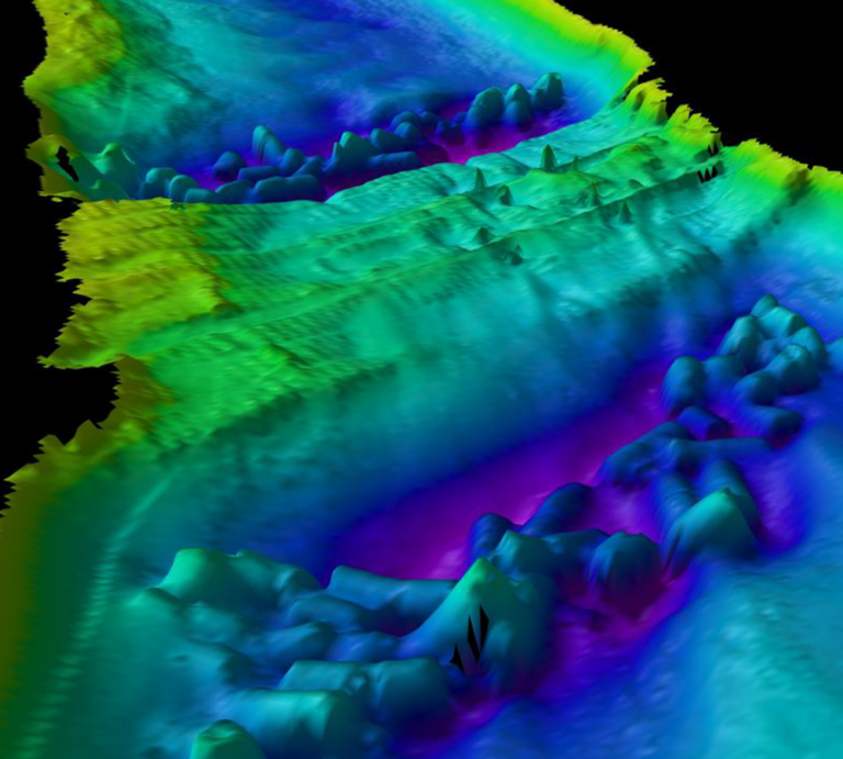
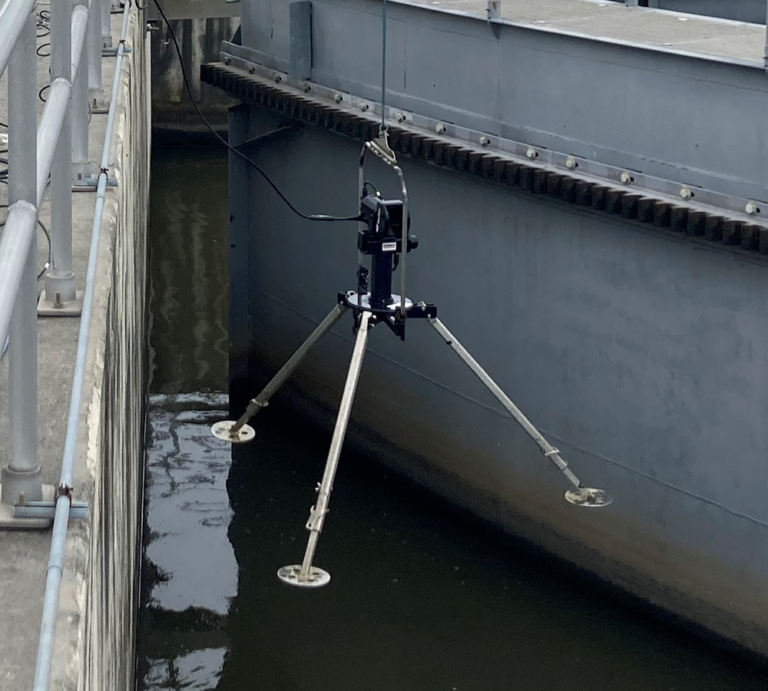
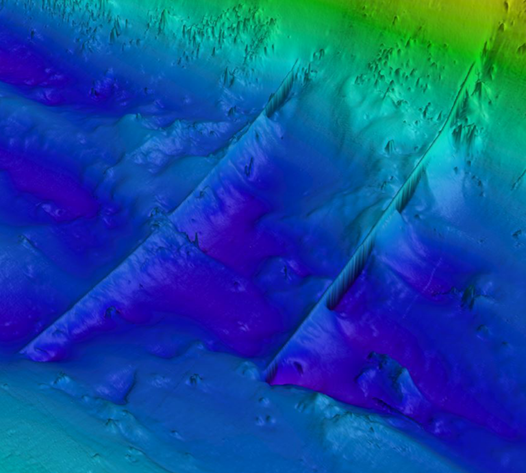
Our Hydrographic Surveys team specializes in shallow-water surveys for various marine and river projects, using advanced surveying technologies and software, including single and multi-beam echosounders, as well as cesium/proton magnetometers. Adhering to the USACE Hydrographic Surveying Manual standards, we ensure precision in every project. Delta Coast Consultants enhances survey accuracy with RTK GPS for real-time tidal adjustments and precise positioning, delivering reliable hydrographic data.
Services Include:
- Single-Beam (Single & Dual Frequency) Bathymetric Surveys
- Multi-Beam Bathymetric Surveys
- Acoustic Doppler Current Profiler (ADCP) Surveys
- Side-Scan Sonar (Acoustic Imagery) Surveys
- Extreme Shallow-water, Light vessel, Bathymetric Surveys
- Dual-Frequency single-beam surveys for riverine / dredging turbidity layer penetration
- Hypack® Max data editing, line merging, tin-model construction, and volume calculation
- Surveys, SAR (Search and Recovery)
- Underwater Inspection Surveys
- Pre and Post-Dredge Volume Surveys
- ADCP Current Velocity mapping
- Full 3D Multibeam Bathymetric Surveys
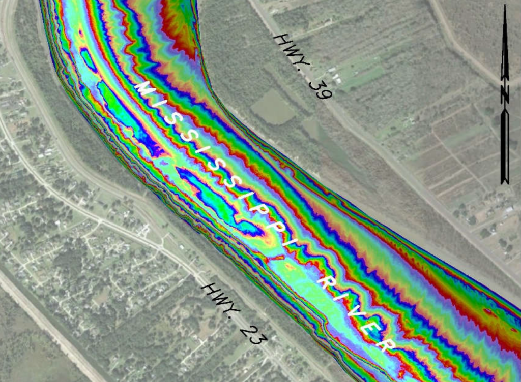
Delta Coast Consultants specializes in Land & Boundary Surveys throughout Louisiana, with a strong focus on riparian boundaries. Our expertise extends to handling land-rights and right-of-way acquisitions on coastal properties. By conducting 3-4 significant boundary surveys each month, we keep our team’s skills finely honed and up-to-date. Our approach includes using the most advanced and effective methods for data collection and staking in property and topographic surveys, ensuring top-tier precision and accuracy.
Services Include:
- Property Surveys
- Subdivision of Property
- ALTA Surveys
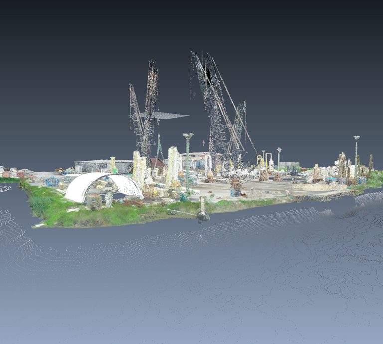
Our Aerial Mapping service harnesses the power of real-time 3D data capture, enabling the detailed mapping of complex structures and landforms and delivering highly accurate 3D models. With FAA-licensed pilots who are also certified and experienced in coastal and land surveying, we bring a unique blend of skills and qualifications to aerial survey data collection.
Services Include:
- UAV (Drone) Remote Sensing
- Aerial LiDAR, Photogrammetry
- Aerial Photography
- Video Inspection
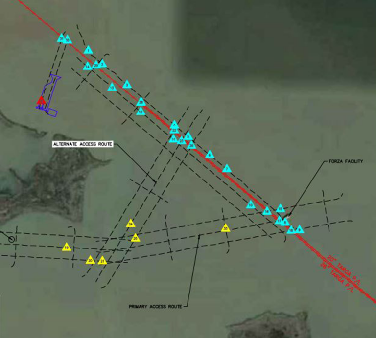
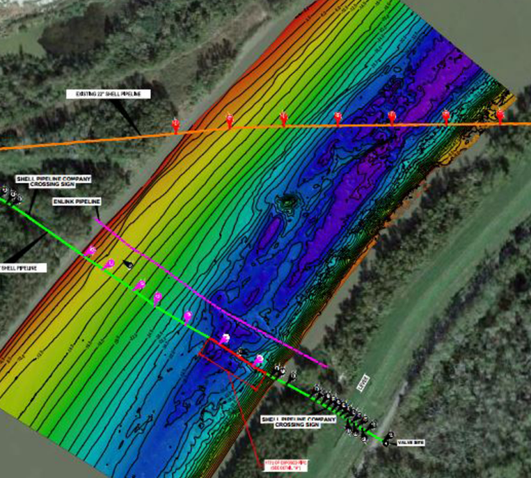
Our Oil & Gas Surveys offer comprehensive support from site selection through to the midstream phase, utilizing the latest technology for efficient, reliable project insights. With extensive experience and flexibility, we handle projects of any size, ensuring precision and reliability for your oil and gas development needs.
Services Include:
- Pipeline Depth of Cover
- Pipeline Waterway Crossing Surveys
- Alignment Studies and Right-of-way Plats
- Utility Locates and One-call Support
Markets
- Property Surveys
- Subdivision of Property
- ALTA Surveys
Surveying for Sustainability
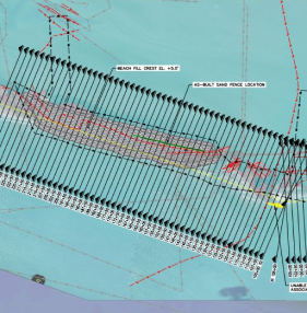
Delta Coast Consultants’ surveying expertise is pivotal in achieving a more resilient Louisiana coastline, offering high-quality data collection and field services for sustainable coastal projects.
By leveraging our specialized knowledge and cutting-edge technologies, we ensure that every coastal project we undertake significantly contributes to the long-term stability and resilience of Louisiana’s coastal environments.
Add Your Heading Text Here
Lorem ipsum dolor sit amet, consectetur adipiscing elit. Ut elit tellus, luctus nec ullamcorper mattis, pulvinar dapibus leo.
This project, designed to offer Category 3 storm surge protection for over 150,000 residents and extensive marshland, showcases our multidisciplinary team’s capability in ensuring the coastal future of Louisiana through effective implementation and management of critical flood protection infrastructure.
Interdisciplinary Engineering
Lorem ipsum dolor sit amet, consectetur adipiscing elit. Ut elit tellus, luctus nec ullamcorper mattis, pulvinar dapibus leo.
You are in capable hands.
Lorem ipsum dolor sit amet, consectetur adipiscing elit. Ut elit tellus, luctus nec ullamcorper mattis, pulvinar dapibus leo.
Timely and Reliable Outcomes
Lorem ipsum dolor sit amet, consectetur adipiscing elit. Ut elit tellus, luctus nec ullamcorper mattis, pulvinar dapibus leo.
Surveying & Mapping Projects
Precision-Driven Surveying & Mapping Solutions
Engage with our dedicated team of surveying and mapping experts.