Survey Control Network for
Morganza to the Gulf
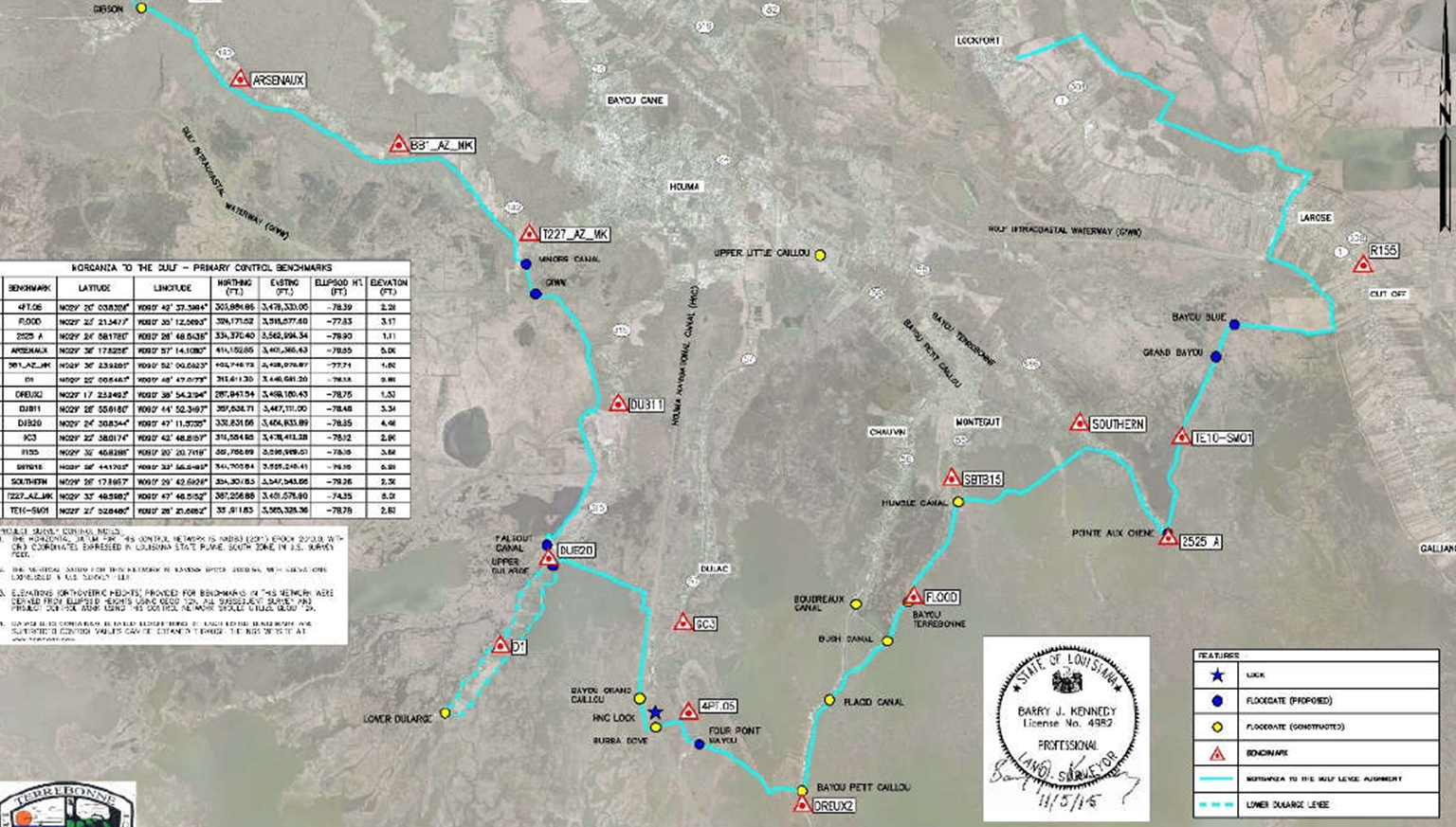
Hurricane Protection System
The Morganza to the Gulf – Hurricane Protection Project is an authorized Federal Flood Protection project which spans approximately 114 miles across the southern portions of Lafourche and Terrebonne Parishes. The Terrebonne Levee and Conservation District, as primary facilitator and Owner of the project, has a responsibility of providing flood protection to the residences of these parishes which is based on the Survey Control Network.
The primary purpose of the Survey Control Network is to provide a series of horizontal and vertical reference points, on a uniform datum, which spans the entire length of the project alignment. Since NGS has previously released information documenting this region as a subsidence area (meaning that these monuments are subjected to downward motion over time), and in an effort to maintain consistent elevations throughout the project alignment it is necessary to periodically adjust the SCN throughout the system alignment. Therefore, the TLCD, every few years performs a static survey of 15 monuments throughout the project alignment and adjusts the elevations to the updated network. The survey benchmarks of the SCN were observed using redundant static GNSS (GPS) observations and processed with GNSS observations from Continuously Operating Reference Stations (CORS) maintained by NGS and the LSU Center for Geoinformatics (C4G).
Share
Facebook
Linkedin
Client Name
Terrebonne Levee and Conservation District
Location
Terrebonne Parish, Louisiana
Sector
Surveying & Mapping
Completion Date
2015
Key Features
System Wide Reference to the Latest Horizontal Adjustments (NAD83)
System Wide Reference to the Latest Height Modernization Adjustments (NAVD88)
Value Benefits
Design Surveys for New MTG Projects
Monitoring Surveys for all Levees and Structures Operated & Maintained by TLCD